An Autumn Trip to Koger Arch

Yamacraw Bridge in summer.
I recently went on a trip to the southern region of Kentucky, close to the Tennessee border. I  have made trips to the area in the past but had a new mission in mind.
McCreary county, off of hwy 27 has very remote, isolated areas that are part of the Daniel Boone National Park. There are very curvy roads, cliffs, overhangs with rock slides and steep drops into valleys.


Koger Arch Sign
My friend and I decided to check out an arch that we visited a few years ago. This time the weather is more conducive for hiking. The last time it was in the middle of the summer when we made the trek and the bugs and heat were too much.


Leaf covered trail


The Koger Arch area is  dotted with many lesser known arches and not as accessible. The best know one is Natural Arch just north  off  hwy  700. This is also in the Stearns  District of   the Forest.

stone steps


Koger Arch now has a new sign on the side of the road so it was a little easier to find. I applaud the volunteers who clear these trails and made steps and directions to these locations. The Sheltowee Trace Hiking group, along with the forest service, maintain the trails and nail in markers on the trees to help hikers find their way. Their symbol is a turtle.

We drove south of Somerset, on hwy 27, past the Natural Arch, until we reached 92 on the right and followed that until Yamacraw bridge. Make a left onto hwy 1363;drive until you see Rock Creek Rd that becomes Wilson Ridge Rd. You should see the new sign on the left side of the road.


Beneath Koger Arch


The arch is larger than I remember, certainly an impressive sight. The leaf covered trail is a little slippery in the fall, so use the walking stick for balance. I couldn't see the steps until we got closer to the arch itself.


All in all I was not disappointed and love to walk in the wilderness. Be careful traveling in these isolated areas. There is no one around if you fall and be hurt. Always bring a friend or two, and of course, your camera. I used my new Sigma wide lens and love the effect.


Koger Arch

Take a Walk on the Wild Side

This weekend I ventured into one of Long Island's natural preserves. The little know Werthein Preserve is located on Smith Rd in Shirley, along the Carmen's River.
I had waited for the cooler weather to arrive and fall colors to explode. This weekend was the best and last time I think the colors and leaves will be seen on the trees.

The renovated Wertheim visitors building is quite impressive! It was built in 2012 and reminds me of an upstate Adirondack retreat, and since the architects  were from Syracuse, that makes sense.
Natural fauna and flora were utilized and the preserve was left heavily wooded, except for some parts of gravel maintenance roadway.

There are two main trails; The Black Tupelo and The White Oak Trails. I chose the White Oak trail which  runs down to the right from the parking lot.


My first stop to capture photos was from the bridge over the creek. The railroad tunnel is well documented by other visitors and I can see why.

Next, the open expanse of the Carmen's Creek  shimmered in the mid day sun, along with the multi colored trees on the banks.

There were a few boardwalks to lookouts on the river along the way as well. starting at the visitors cabin, I walked along the wooded path of the White Oak trail as it meandered along the edge of the water and into the woods, which looped back to the visitors cabin. The longest part takes almost three hours but I took the short cut.

If you were stressed before arriving, I guarantee you would be relaxed by the time you walked to the water. It seems to be a great tranquilizer.

Next time I will veer left on the Tupelo trail, that runs about 3 miles altogether.

I found more preserves on Long Island, mostly in Suffolk County and would like to visit them as well.

A Walk in Beauty

I recently joined a walking /hiking group that picks a different park or preserve to venture out into on weekends.
Living in the suburbs outside of Manhattan  can be stressful with the traffic, crowded stores and the rushing around during the workweek.

Saturday and Sunday can be quite hectic as well as some of us try to jam into these two days, all the fun and relaxation that we don't have time for during the week.
It's funny to think that this can create just as much stress as working.

There are wonderful gems of  undeveloped properties in Suffolk County so I am discovering them once again after a long hiatus out of state.

I enjoy the group of like-minded individuals who just wanted to commune with nature.We met at the parking lot of Connetquot State Park and started our 4-5 mile journey down the dirt path.
Our first stop was the fish hatchery, that recently opened again.
This was quaint and reminds one of the good ole days.
I actually saw some fish in the creek.

After that stop, we walked a bit and stopped at a bridge to gaze upon the beautiful hues of the late summer.
Trees were already changing the colors and the stream had a fascinating green bottom vegetation that seemed to sway in the currents.


The next leg of our walk was rather long,as we meandering through the pines and wilderness. I was falling further behind as I stopped to photograph and tried to keep up.


Luckily two other walkers were also falling behind and wanted to keep a slower pace.
The group noticed we were missing so they were waiting around the curve as we made our way after the 5th mile. The leader announced that we were going a further route today due to the tall grass that hid ticks on the other trail. Oh, that's why I'm tired! The temperature also had risen more than anticipated and was taking its toll.
As we carried on for the last leg of the 2 1/2 hour trek, a beautiful pond or lake filled with swans appeared. How graceful they looked!

I shot some photos again.
The Old Huntsmen Lodge was the last building I shot  (pardon the pun) before departing again for the car. I was happy to cool off and get back home to see my photos for the day.


Try to find your little oasis each week so you can refresh your batteries and get a new appreciation for what you have available.

Summer Was Lively

Summer is known for being the liveliest season of the year for me. At least that's true for the northeast. This is the season that every living creature and human tries to do as much as they possibly can in the short 3-4 months of sun and heat.

After sitting in the house this past winter and spring, most of us shoved as many activities into the weekends as we could.
The animals and insects were no exception. For some reason, the inch worms, caterpillars, ticks, and mosquitoes were in over abundant supply!  We dared not venture out in the morning or evening hours or we would suffer the consequences of the hungry, blood suckers.

I had so many welts on my legs and arms this summer!  They say it was due to the massive amount of snow.
I have always enjoyed studying insects, birds, and most other animals.  I was lucky to capture this tiny pray mantis waiting on a flower stem near a small pond. He or she seemed to be watching me but sat very still. This tiny creature was probably a baby since it measured  only a few inches. This turned out to be a good thing since my love of photography fit right in to this activity well.

I managed to capture some interesting images of  a few creatures and even had them printed on a few items for keepsakes. An example is the Dragonfly ceramic tile I had printed with my photo. I had to wait over a few hours and take many shots before I captured this little fellow.


Now that summer is coming to a close, we can remember all the sights and sounds with some mementos.I had this printed on a ceramic tile and created text. Using your photos makes a personal gift.

An Afternoon at the Lake

Green River Lake State Park in Taylor County, KY is a lovely lake that was created by a dam built by the Army Corp of Engineers. Like most of the man-made lakes, it is also maintained by the Army Corp.

There are marinas, campsites and wilderness trails surrounding it.

I recently ventured in the park after living nearby for 8 years. I don't know why it took so long to check it out but I'm glad I did.

It isn't very primitive like most of the parks I've visited,  but it's worth the trip since it is so close.

Going in the autumn and winter allows me to wander and shoot nature undisturbed.


The first trail my friend and I entered was the Beaver Pond and Salisman Trail. This is the first one on the left after crossing the dam. The trail is almost invisible due to leaves covering it and so we didn't stay long but did find another visitor along the way.


The Eastern Box turtle crossed the path, searching for mushrooms. He or she let me photo graph them so may be he or she were used to visitors.


We drove to another picnic area which was
 surrounded by beautiful colors of autumn leaves.


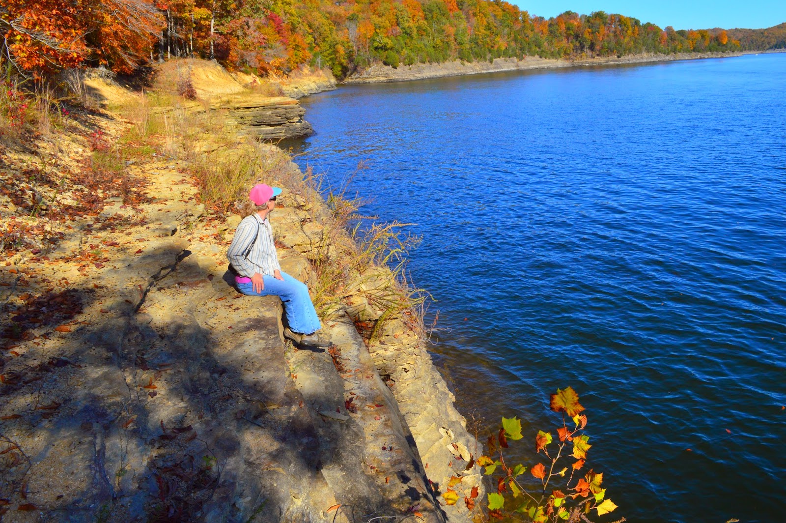
My friend is posing on the fence. Notice the blue lake in the background.


The beach is closed but the warm November day was so inviting.


Boaters enjoyed the open water I'm sure.
The brown and red background are a wonderful contrast to the blue lake.


The southern part of the lake at the end of lakeside trail shows an open span of water.

My friend was brave enough to sit on the edge...I wasn't !

It's such a peaceful place to relax for the afternoon and just think.

I


We climbed back up the hill to the car and bid a fond farewell.  I will return and snap more photos I'm sure.


Sometimes we need to check out the local

A Big Surprise at Yahoo Falls


The morning clouds left me annoyed, thinking that it would turn out to be another dark cold day like the previous one.

But by 11am, breaks of sun popped through and my mood immediately lightened.
Yay! I'm going out to visit one of my favorite locations to photograph nature; Yahoo Falls.

It turned out to be a beautiful Sunday afternoon . The temperatures had risen to the low sixties; all the way up from a morning low of 49 degrees!

I have been to Yahoo Falls at least 4 times in almost every season. It is located in the upper part of the Big South Fork National  River and Recreation area that extends into Alardt, TN.  Daniel Boone Forest and Big South Fork are connected and it's hard to tell where one area stops and another begins except for the signs.


Yahoo Falls is easy to find. If you drive north from Tennessee, on highway 27, you will turn left onto highway 700, in Whitley City, KY.
If traveling south on highway 27, just turn right on highway 700.
Follow this narrow, winding road, slowly and you will reach the signs about a few miles due west.


I bought along a friend who had never seen this before so it was a treat.
There is an overlook near the parking lot and the water is always green. The fall colors are just changing and I didn't want to miss them. There are about three overlooks along the way to the falls.
I discovered that the falls does not enter or come from the river at all. it comes from a small creek on top of a ridge, and hikers can cross over and stand over the falls.

There are several ways to get down to the falls, so we picked the red, metal, steep, stairs. This is fine going down but not going up!


The recent rains made a decent amount of water for the fall to be photographed. There were other visitors around so maneuvering to get a good shot proved a challenge this day.


Due to the shade I had to raise the cameras ISO to 1600 and 3200 so there was some graininess, when magnified.

Photographers love to get clear crisp shots but nature doesn't always provide the best lighting.


The Yahoo Arch was next on the agenda so off we went.
The trail seemed a little longer than a year ago. It ascended steep hills and turned many times. I was a little breathless at some points and had to rest. I guess I am getting old or need more practice.


At last we found the arch. Actually it seems to be a rock house an arch and a cave with a hole on top. It never disappoints, at any case.


After snapping photos for 30 minutes, we decided to go back. There is another arch named marker arch further up the ridge about a 1.6 miles but it was getting late.

We walked back through the heavy woods and we stayed on the upper path this time. It was shorter.
As we came to the top of the falls, my friend decided to venture on top; I wasn't as brave.

I have wondered through the woods of Daniel Boone National Forest and the Great South Fork National Recreational and River Area for a few years now and never encountered any wildlife larger than a squirrel or rabbit. Black bear alerts were posted on most trails so I kept an eye out for them.

Then as we left the park road and drove down the road a little when something caught my eye. A very dark image appeared next to the road. I drove slowly up to this and saw the eyes and realized it was a black bear! My first encounter after all the trips and hikes. I was so amazed, scared and delighted at the same time!

My friend had the vantage point and managed to get a few shots before I could get my camera out of its bag. The young bear quickly walked away as he realized we were not there to feed him.

So here's my first bear sighting. I am so glad we didn't meet up with this on foot!


Slave Falls TN Summer Afternoon Adventure

My last post described the two Twin Arches in the Great South Fork Region in Picket County Tennessee. I stated that Slave falls would be posted next.


Slave Falls is a few miles away from the Twin North and South Arches in the same park. This is located in a heavily wooded, rocky terrain with good paths.
Take hwy 154 east from hwy 127 near Jamestown,TN.


Turn right onto Divide Road and then travel about 4 miles on Ridge Fork Rd.  Follow the signs on  the way to Charit Creek Lodge . The Sawmill Trail parking will come up first so park on the grassy lot in front of the trail head.


 There is a map of the trails as you enter the trailhead so we took a photo of this to help navigate through the area.
This preserve has a history of logging so the sawmill trail name made sense but any remnants of the old sawmill are gone.
The woods is very thick in the summer and the shade from the trees was welcome on this humid day but I will return in the falls and maybe winter when more can be seen.
On the way ,we passed cliffs, creeks, and overhangs. There was a sign for the rockhouse too, but we decided to do this another day.

We made our way to the side of Slave Falls but I was disappointed by the size of it. I guess they didn't get as much rain and so it was difficult to capture a good shot. My boyfriend scaled over the fence in an attempt to get that good shot.
Since the water falls over a huge overhang ,one could consider this to be a rockhouse, but it was impractical to walk through with the large boulders.


After climbing out of the bottom, we ventured on a trail that we thought would take to another great site and saved our disappointing trip. Needle Arch is a wonderful intact natural rock formation that is on the same path down from the falls.

The wide angle lens makes an interesting perspective.
After leaving the arch we continued on the trail that we thought would take us back to the car but it didn't!
We somehow got turned around and ended up on the other side of the falls!
The two hour hike wound up taking almost four hours and my feet were swollen.

Hiking on hot, humid days does take its toll. I was so happy to see the car and turn on the air conditioning. Yes I am just a day tripper. We came upon hearty campers and hikers that stayed overnight but I don't know how they deal with the creepy crawlies in the night!